 |
|||||||||||||||||
North Reserve |
|||||||||||||||||
HISTORY |
|||||||||||||||||
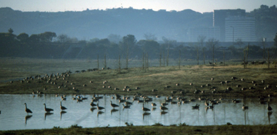
What we now call the North Reserve, prior to its development in 1988 as a Wildlife Reserve, was agricultural – grazing led to wheat, then corn, then sod. After the 1971 Sylmar earthquake, which weakened the lining of the Van Norman Reservoir in the north Valley, pits were dug to excavate the clay soil (Mocho loam) that was perfect for re-lining the Van Norman Reservoir. These “borrow” pits or depressions filled with water during winter and were wonderful and wild wetland habitats that attracted many different bird species. |
||
The Sepulveda Basin Master Plan and Final Environmental Impact Report/Statement that was finalized in March 1981 called for “designing reaches of newly-formed lakes and ponds to emulate existing wetland conditions on the site and by replanting existing riparian species” and “accompanying new park developments with the introduction of native plant species to create new habitats in the basin…” |
||
The Master Plan called for a Wildlife Management Area Extension (60 acres) as follows: “The area north of Burbank Blvd. immediately west of the dam would, in this plan, accommodate a 60-acre extension of the Wildlife Management Area … south of Burbank Blvd. The area is conceived to provide a more substantial setting for wildlife than is possible in the relatively constrained environment south of Burbank. The borrow areas created by previous removal of clay material would be maintained as constant lakes by diversion of reclaimed water, so that the basic wildlife theme of this area could be waterfowl.” |
||
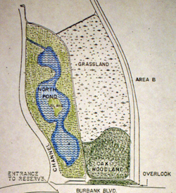
| The original Corps of Engineers plan for North Reserve was implemented as shown above except for the extension of the oak woodland north of the trail just north of the Burbank Blvd. berm. Also, the inlet is shown coming off of the “channel” (Haskell Creek), and instead it enters the “north pond” (Wildlife Lake) via a pipe. |
||
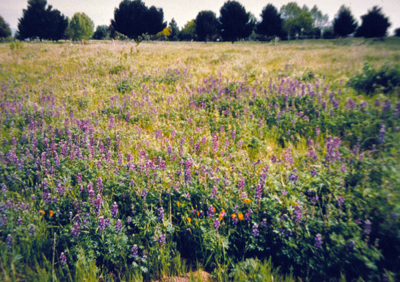
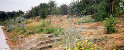
In 1988 the area was graded and the lake dug, and in the late summer the planting was done. Besides hydromulching various annuals such as lupine and poppies, over 7,000 cutings consisting of mulefat and three kinds of willow (Salix lasiolepis, S. laevigata, and S. goodingii) were planted. About 400 5-gallon containers which included elderberry (Sambucus mexicanus), white alder (Alnus rhombifolia), Arizona ash (Fraxinus velutina), and cottonwood (Populus fremontii) were planted along with over 5,000 1-gallon cans of a combination of coyote bush (Baccharis emoryi), wild blackberry (Rubus ursinus), golden currants (Ribes aureum) and California rose (Rosa californica). |
||
The Wildlife Reserve was an anomaly for the City Rec. & Parks staff; except for Griffith Park, all other properties managed by the City Rec. & Parks staff were traditional parks with lawn, ornamental trees, restrooms and other park facilities. This designated Wildlife Reserve was different. Fortunately the City decided to sponsor the Sepulveda Basin Wildlife Areas Steering Committee in order to get advice about how to manage the Reserve. Once the City learned that mowing was a “no-no” they were pleased not to have to mow this large area; the Committee urged the City not to disturb the soil (which leads to weeds), to control the weeds that were infesting the recently disturbed area, and to arrange for additional plantings to make up for the thousands of cuttings that never took (due to being planted in the middle of summer). |
||
Wildlife Lake and Island |
||
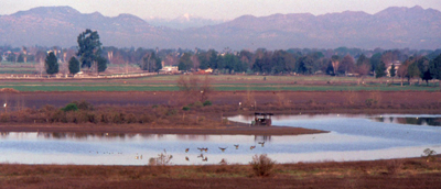
The main feature of the North Reserve is the 11-acre Wildlife Lake with its island. For the first few years of the Lake’s existence, it was a seasonal lake, being filled with potable water in the fall and then drained in the late spring. Until the reclaimed water pipeline was established, it was very expensive for the City to supply fresh water to the Lake, and during those years there was a severe drought in the region. However, with public pressure (including a “bucket brigade” led by local activist Jill Swift), the Lake was filled each fall until the reclaimed water became available in the early 1990’s. |
||
The banks of the Wildlife Lake were pretty much bare until the Lake was filled with water permanently, and native cattails and bulrushes were imported and planted along the edge of the lake. |
||
The island didn’t offer waterfowl protection until the Lake was permanently filled. Once filled, however, it began to provide safe nesting and resting grounds for an ever increasing variety of birds. Once the Lake was permanently filled, due to the reclaimed water exiting the Lake via Haskell Creek and then entering the Los Angeles River that flows to the ocean, each day the City monitors the water by taking water samples from various locations in the Lake, using a small boat. |
||
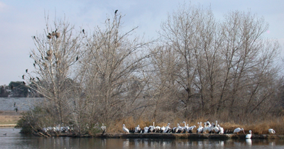
The cottonwood trees that were planted on the island took awhile to get big enough to support nests, but now they host nesting cormorants. Pelicans and other waterfowl take refuge on the island as well. |
||
Haskell Creek |
||
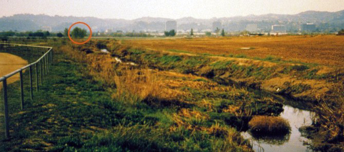
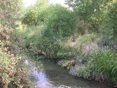
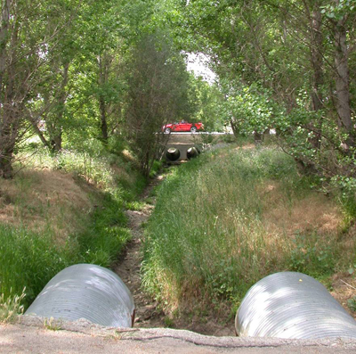
Originally known as Haskell Channel, this drainage from the far north Valley (near O’Melveny Park) is channelized as it travels south, entering the Basin just south of Victory Blvd. The portion between Victory Blvd. and the Wildlife Reserve is unmanaged, overgrown with non-native trees, and only has water when there is adequate rainfall. In the north Reserve, Haskell Creek flows under the Reserve entry road, through a Fremont cottonwood forest of 48 trees that were planted in 1993, a grove to honor the late David Lewis, a staunch supporter of open space in the Sepulveda Basin. Just north of the first bridge, reclaimed water is pumped into the Creek, recharging it year around. Between the first and second bridges the Creek was re-graded during the 1999 expansion project, and is lined with willow trees that by 2008 had grown to over 20’ in height. All along the Creek in the North Reserve are Fremont cottonwood trees that were planted in 1988, some of which are beginning to get very large and are dropping limbs during high winds. Just north of Burbank Blvd., the Wildlife Lake flows into Haskell Creek, that then flows in a tunnel under Burbank Blvd. to the South Reserve, where it turns to the west and eventually flows into the L.A. River. |
||
 |
Up until 1999, the North Reserve’s western boundary was Haskell Creek, as sod was cultivated to the west of Haskell Creek. Because the Tillman Flood Protection Project required compensating excavation (the lowering of the ground level of the Basin by removing huge volumes of soil), the sod farms were removed, and the excavation took place in the mid-1990’s. |
||
The 1999 Wildlife Reserve expansion project included two bridges that crossed Haskell Creek, linking the areas on either side of Haskell Creek, and a perimeter trail was built in the added portion between Woodley Ave and Haskell Creek. Valley and coast live oak trees were planted. |
||
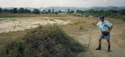
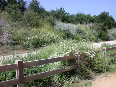
Unfortunately, one of the results of lowering the ground level was to ostensibly raise the water table, resulting in an invasion by non-native poison hemlock (Conium maculatum) and fennel (Foeniculum vulgare). The fennel has been somewhat controlled over the years, but the poison hemlock is a serious problem. While natives shrubs such as elderberry, coyote bush, mulefat, mugwort and western ragweed have reclaimed some of the area, annual weeds such as mustards, wild radish, thistles and horehound are making it harder for the natives to re-establish. |
||
On the west side of Woodley Ave is another portion of the Wildlife Reserve, but it is not available for public use, as it is situated under the flight zone for the model airplane field. This area is managed to control weeds and eliminate trees that would hinder the flying of model planes. |
||
Flora |
||
The original 1988 planting specifications called for three zones: mixed shrub, mixed willow, and dense willow. Unfortunately ALL the willow cuttings perished in the hot summer sun, despite an irrigation system that resulted in circular “rings” of weeds and the hydromulched brief appearance of annual lupines and poppies. At the time the Reserve was created in 1988, there was only one “original” willow, a medium size tree in Haskell Creek |
||
One thing that is apparent: if there is adequate water there will be riparian vegetation, and it grows really fast. Another discover is that the clay soil of the Wildlife Lake does not allow much water to seep into the ground. When the lake was lowered for maintenance, it was possible to dig into the side of the lake, and the clay was dry 2’ from the surface. Because of this, trees that were planted around the Lake are stunted in comparison with the trees that are along or adjacent to Haskell Creek, as the roots of those trees can penetrate into the perennially wet creek bottom. In fact, one can see where small trees are sprouting from exposed roots near the creek bottom. |
||
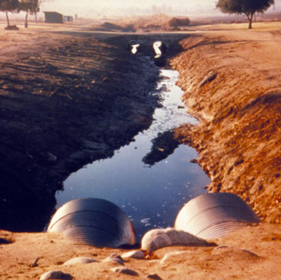
Soon after the North Reserve was completed there were two chemical spills into Haskell Channel in the industrial areas north of the Basin. Hastily erected earthen dams were built along Haskell Creek in the North Reserve where equipment was brought in to remove the harmful chemicals. Fines were levied against the offending companies, and approximately $100,000 was directed to be spent in the Sepulveda Basin Wildlife Area as mitigation. These funds were spent on supporting the Audubon Society’s youth education program, revegetating the north berm of Burbank Blvd. with a project called Hummingbird Hill and Woodland, and for ongoing herbicide control of the worst invasive non-native weeds and trees. |
||
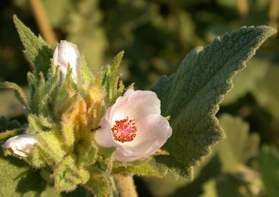 |
The North Reserve has been most intensively managed for weeds. The management plan calls for complete control of perennial plants such as tree of heaven, castor bean, evergreen ash, Harding grass, Johnson grass, and horehound. Annual weeds are more difficult to control, due to the large seedbank, but the plan calls for controlling milk, bull and Russian thistles, although there was a recent (2007) huge outbreak of Russian thistle. For the time being, non-native annual grasses, mustard and radish, horseweed are tolerated. |
||
Native shrubs (most of which were planted except for Western ragweed, verbena and possibly fiddleneck) include coyote bush (Baccharis pilularis and B. emoryi), mulefat, California rose, golden currant, and wild grape (Vitis girdiana). Aquatic vegetation in the Lake includes willow water-weed (Ludwigia peploides) and willow smartweed (Polygonum lapathifolium). Trees include box elder, Fremont and black cottonwood, willows, Arizona ash, California walnut, and Mexican elderberry. |
||
Fauna |
||
The wide variety of birds visiting the different habitats makes for a lot of different birds (over 200 species). Click HERE to download a list of birds found in the Sepulveda Basin. Bird watching is great any time of year, but in the springtime before the cottonwoods leaf out is best. Some rare and hard to find species occur here, including breeding blue grosbeaks, that have historically been present. But not so with many of the birds that are common in the North Reserve today. The reason why Hummingbird Hill was named is in the early stages there were no hummingbird plants, hence no hummingbirds. So hummingbird-attracting plants were planted out and soon the birds arrived too. It also took about a decade before bushtits and other shrubland birds appeared. There are still no resident woodpeckers (not enough dead wood, large trees) and no quail (not enough mature oak trees). |
||
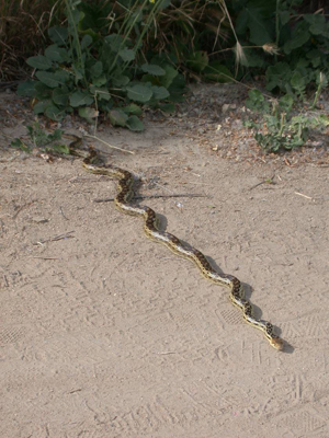
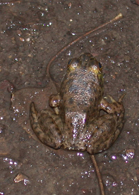
Mammals include Audubon’s cottontail, California ground squirrel, Bott’s pocket gopher, and non-native roof rats, feral cats and possums. Occasionally there are sightings of coyotes and possibly raccoons. There are gopher snakes, western fence lizards, side-blotched lizards, western pond turtles, non-native red-eared turtles, and bullfrogs. |
||
 |
Fire |
||
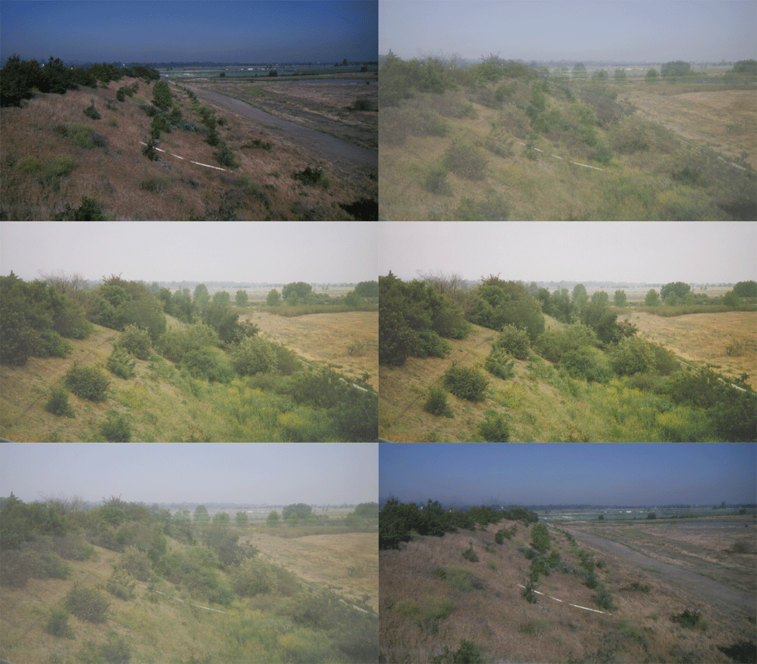
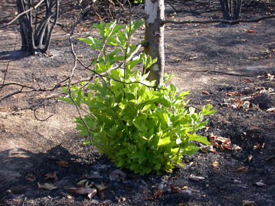
Fire is always a possibility in the Reserve, primarily from homeless encampments, but also from model airplanes that crash and literally “burn.” In June 2002 the largest fire burned a large portion of the North Reserve (see below). |
||
Fortunately most of the trees and shrubs were able to resprout, but some of the larger trees were lost. |
||
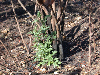 |
above, resprouting sycamore and elderberry three months after the fire of 2002. |
||

