Click HERE for a Regional Trail Map of the Basin (13.26MB pdf file) – Click HERE for a local trail map of the Wildlife Reserve

DIRECTIONS TO THE WILDLIFE RESERVE and MAIN TRAIL
Turn north from Burbank Blvd. (or south from Victory Blvd.) onto Woodley Ave., which is ½ mile west of the San Diego Freeway (I-405). Travel about ½ mile to the sign for the Wildlife Reserve (and Japanese Gardens). Turn east onto Wildlife Way, a park road. Bear right at the immediate fork in the road and go east ½ mile to the Wildlife Reserve parking on your left. The Wildlife Reserve is to the south...follow the trail down from the restrooms area. To use online mapping programs, use 6100 Woodley Avenue, and that will take you to the park road (“Wildlife Way”) leading to the Wildlife Reserve’s parking lot at the road’s east end. Park in the lot, then walk south past the monumental rocks and restroom building to the amphitheater. Follow the trail leading from the "stonehenge" restroom/amphitheatre area south towards the entrance to the Wildlife Reserve.
You can walk all the way down to the LA River, but if you do (the trail leads through a tunnel under Burbank Blvd.) be sure to go with another person.


Join us for the Dawn Patrol or 4th Saturday Weeders at the Sepulveda Basin Wildlife Reserve!


Dates and times: 

Dawn Patrol: Every Tuesday and Thursday from 6:15-9:30am 
Email George at moiraw@earthlink.net if you are interested in joining. 
4th Saturday Weeders: Every fourth Saturday from 7-10am - mark your calendars!
3/23/24

4/27/24

5/18/24 (3rd Saturday due to Memorial Day)

6/22/24

If you can’t make it at 7:00am, we should be just off a path near the pond.

Meeting Location: Sepulveda Basin Wildlife Reserve

Dirt parking lot beneath the Big Pine (restrooms located nearby).


Who will be there? Everyone is welcome!

We hope you'll be able to join us and please forward this website to anyone you think might enjoy the opportunity to get outside, meet a great group of people, help the environment, and/or learn about flora and fauna (all while ripping up some invasive plants, which for simplification we call ’weeds’).


How to sign up: Email George at moiraw@earthlink.net by the Friday before so we can get a count - walk-ins welcome.  

Interested in being on the mailing list or volunteering on a different Saturday/own your own (weeding or picking up garbage)?

What to bring: Gloves and tools if you have them- we do have some extras. We also recommend you bring water, snacks and sunscreen, and wear a hat, long sleeves and pants for protection. 


Our goal: The California Native Plant Society (CNPS) has an ongoing invasive plant removal effort throughout California. Our goal, as the 4th Saturday Weeders (you don’t have to be a member of CNPS), is to improve the habitat of the Sepulveda Basin Wildlife Reserve by removing invasive plants. We find that if ‘weeds’ are removed consistently for three years Native Plants are able to establish themselves (and the ‘weeds’ are much more controllable). We have a lot of expertise on the plants and have been able to make an important contribution to the Wildlife Reserve over the past 12 years!


Volunteer hours: If you need your volunteer hours tracked for anything from work to school, George at moiraw@earthlink.net is able to provide you with the verification you need.


We look forward to seeing you!


Click HERE to read about ongoing revegetation activities in the Wildlife Reserve.

Tuesday, March 26, 6:30pm -9pm In Person
SEPULVEDA BASIN WILDLIFE AREAS STEERING COMMITTEE
17015 Burbank Blvd., Encino, CA 91316 - Balboa Sports Center.

Sunday, April 7, 2024, 8am
First Sunday Monthly Bird Walk
Sponsored by San Fernando Valley Audubon Society, led by Kris Ohlenkamp

Meet in the reserve's paved parking lot at the end of the park road.  Bird walk lasts 3+ hours.
Information:  Kris Ohlenkamp, 818.521-8799.

Free Guided Tours of the Sepulveda Basin Wildlife Reserve
Second Saturdays, 9:00 A.M. monthly thru March 2024

Tours of this special place will begin at 9:00 A.M. and last 1.5 – 2 hours,
depending on the group’s wishes.

San Fernando Valley Audubon invites you to guided tours of the reserve on
Second Saturdays. The walks will include the many birds, other wildlife,
habitat, and recovery from the devastating fire of September 2020. The
emphasis of each tour will vary with participants’ interests.

CLICK HERE FOR MORE INFORMATION


About this Website
 
SBWASC Mission Statement
 
 
This website is sponsored by the Sepulveda Basin Wildlife Areas Steering Committee (SBWASC) that has been meeting monthly since June 1990. The purpose of the Committee is to advise the City of Los Angeles Department of Recreation and Parks concerning the operation, maintenance, and improvement of the existing wildlife areas and any future expansion thereof. The Committee may also make recommendations on matters concerning flora, fauna, and other natural resources in other areas within the Sepulveda Basin, such as the Los Angeles River and its tributaries, park land, and open spaces.

The membership of the Committee is comprised of organizations with a demonstrated interest in flora, fauna, and other natural resources within the Sepulveda Basin. See the bottom of this page to see the logos of the member organizations and other affiliated agencies, or click the tab at the top of the page.

Minutes of the SBWASC can be found here.

Regular meetings of the Committee are held every other month generally on the fourth Tuesday at 6:30pm.
 See “Upcoming Events” on this page for next meeting.

DIRECTIONS TO THE WILDLIFE RESERVE and MAIN TRAIL

Turn north from Burbank Blvd. (or south from Victory Blvd.) onto Woodley Ave., which is ½ mile west of the San Diego Freeway (I-405). Travel about ½ mile to the sign for the Wildlife Reserve (and Japanese Gardens).
Turn east onto Wildlife Way, a park road.

Bear right at the immediate fork in the road and go east ½ mile to the Wildlife Reserve parking on your left. The Wildlife Reserve is to the south...follow the trail down from the restrooms area.

To use online mapping programs, use 6100 Woodley Avenue, and that will take you to the park road (“Wildlife Way”) leading to the Wildlife Reserve’s parking lot at the road’s east end.

Park in the lot, then walk south past the monumental rocks and restroom building to the amphitheater.
Follow the trail leading from the "stonehenge" restroom/amphitheatre area south towards the entrance to the Wildlife Reserve.

You can walk all the way down to the LA River, but if you do (the trail leads through a tunnel under Burbank Blvd.) be sure to go with another person.

Click HERE for A Regional Trail Map of the Basin (13.26MB pdf file)
Click HERE for a local trail map of the Wildlife Reserve
RULES AND REGULATIONS
The “Public Recreational Use Plan Sepulveda Basin Wildlife Area” was signed and agreed to in 1987 by the City of Los Angeles, the U.S. Army Corps of Engineers, and the State of California Department of Fish and Game (copy attached). The “Public Access and Use” section (beginning on Page 6) provides, in part, as follows:

"Therefore the following rules and/or regulations will be enforced within the Wildlife Area by City park rangers and City police. These rules will be incorporated in appropriate public use information signs and posted at the entrance and appropriate locations with the wildlife area.

1. Public use shall be allowed on the Wildlife Area during daylight hours only.

2. Camping, open fires, and the use of gas cooking stoves on the Wildlife Area is prohibited.

3. All visitors shall remain on the designated trail. There will be no public access to the east side of the wildlife lake to prevent disturbance to wildlife.

4. Bicycles, skateboards, or rollerskating will not be allowed in the Wildlife Area.

5. No person shall drive, operate, leave or stop any motor vehicle, off-road vehicle, or tractor in the Wildlife Management Area except for maintenance vehicles.

6. No person shall swim, wade, or dive within the Wildlife Area.

7. No person shall launch or operate a boat or other floating device within the Wildlife Area.

8. No person shall disturb or take any bird, nest, or eggs thereof, or any plant, mammal, fish, mollusk, crustacean, amphibian, reptile or any other form of plant or animal within the Wildlife Area.

9. No person shall possess, fire or discharge any firearm, bow and arrow, air or gas gun, spear gun, or any other weapon of any kind within or into the Wildlife Area.

10. Individual user permits will not be required; however, a visitor sign-in booth will be located at the entrances and will be maintained by the City.

11. All commercial activities are prohibited on the Wildlife Area. Large organizational groups of over 50 people will require prior Parks and Recreation (City) approval before use of the Wildlife Area. Permit Office 818-756-8187

12. The release of any fish or wildlife species, domestic or domesticated species, or the introduction of any plant species, is prohibited.

13. The feeding of wildlife is prohibited.

14. Pets, including dogs, cats and horses are prohibited from entering the Wildlife Area."

CLICK HERE FOR SAFETY PRECAUTIONS WHEN RECREATING IN THE LA RIVER
Recommendations for recreational users include:
- No swimming
- After rain, wait 72 hours before entering recreational zones
- Avoid face-to-hand river water contact
- Wash hands and exposed skin after water contact
 

The mission of the Committee shall be to oversee, in its advisory capacity, the wildlife refuge areas and other areas of present or potential natural value within the Sepulveda Basin, as well as to support policies and programs that ensure their long-term preservation, protection, and enhancement.

NO DOGS ALLOWED

Article 3, Section 63.44 of the Los Angeles Municipal Code contains Regulations Affecting Park and Recreation Areas.  63.44 B-2 mandates that all dogs be on a leash less than 6 feet long, B.8.   'No person shall land, release, take off or fly any balloon, except children toy balloons not inflated with any flammable material, helicopter, parakeet, hang glider, aircraft or powered models thereof, except in areas specifically set aside therefor, B-10 prohibits bows or crossbows, B-11 prohibits the take/seizure/hunting of all birds/animals/fish, B-12 bans the removal of wood/plants/rocks/soil, B-13 makes it illegal to deface any property (including plants), B-14 prohibits all loitering between 10:30 PM and 5:00 AM, B-16 prohibits all human or motor powered vehicles (except on trails or roads specifically for that purpose), B-17 bans all fires, B-19 prohibits littering, B-21 bans firearms.

NO DRONES ALLOWED

Who to Call

For emergency (life-threatening) situations:  

1.      LAPD -- 911.

2.      Park Ranger Dispatch – 323-644-6661

If you witness people shooting birds or other wildlife:

1.      LAPD – 911

2.      Park Ranger Dispatch – 323-644-6661

3.      California Fish & Wildlife –
1-888-334-2258

For non-emergency problems (examples: dogs off leash, fishing,
hunting without firearms, off trail hiking, parking on grass):

1.      Call 1-888-ASK-LAPD
(or 1-888-275-5273)

2.      California Fish & Wildlife –
1-888-334-2258
(hunting or fishing)

For CF&W, a recording will come on and give you a menu. PRESS ZERO for the operator and the operator will ask for the "violation in progress" and your location and transfer you to the applicable Fish and Game division department. State that Warden Kory Collins is in charge of the area and should be notified of the problem.

LA City Animal Services West Valley
818-756-9325 and 818-756-9356

California Wildlife Center
310-456-9453 or 818-222-2658

www.wildlifeservices.org


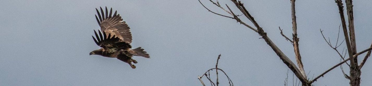
Interesting, we lose an eagle (below) and gain a juvenile bald eagle (?). Photo by James Baker on February 27, 2023.

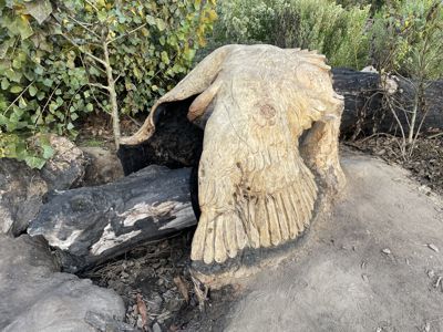
SAD NEWS. VANDAL TORCHED PETE'S EAGLE

No Longer There.

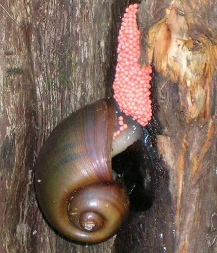
We have discovered the Channeled Apple Snail which is a non-native invasive mollusc that lays pink eggs.
If you see these eggs squash them.
Here is a LINK to a notice posted by the California Department of Fish and Wildlife

Below,
Channeled apple snail laying an egg mass, which typically contains between 200 – 600 bright pink eggs.
Photo by Katasha Cornwell, Florida Department of Transportation.

Channeled apple snail laying an egg mass


NATIVE PLANT VIDEO SERIES
PRODUCED BY DEBORAH A. KEATON


California Wild Rose
Galls on Cottonwood
Holly Leaf Cherry
Evening Primrose
Milkweed/Monarch Caterpillar
Weeding Mustard

Great Photography - Sepulveda Basin Wildlife Reserve - By Joe Doherty

iNaturalist Observations in the Sepulveda Basin

Sepulveda Basin Encampment Cleanups January 2020

 https://abc7.com/society/sepulveda-basin-encampment-cleanup-enters-final-phase-/5825852/

https://patch.com/california/encino/cleanup-sepulveda-basin-homeless-camps-targets-remaining-group

Short ABC7 video about volunteers in the Wildlife Reserve
Click HERE

Wildlife Sightings and Conservation
Click HERE


About the Sepulveda Flood Control Basin
 
   
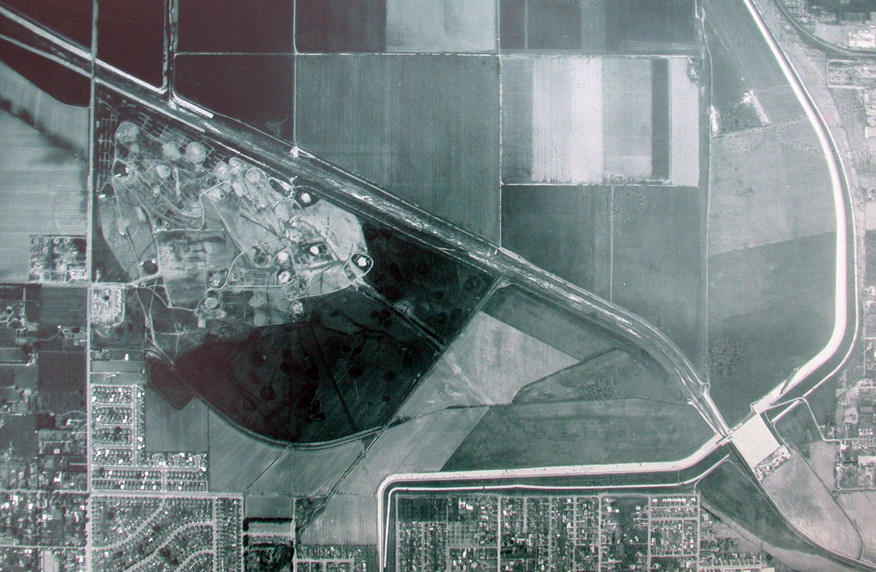
All property within the Sepulveda Flood Control Basin is owned by the Los Angeles District Corps of Engineers, but more than 80% of the land is leased out for recreational and agricultural uses. Sepulveda Dam, completed in 1941, is a dry-land reservoir, with the purpose of controlling runoff from nearby San Gabriel, Santa Monica, and Santa Susana Mountains.

Besides the Encino and Balboa golf courses, the Balboa Sports Complex, and the model airplane field, most of the Basin was devoted to agriculture (corn and then sod farms). In the mid-1960’s, Burbank Blvd. was extended across the Basin. In the 1970’s the City of Los Angeles Bureau of Sanitation built the Donald Tillman Water Reclamation Plant within the Basin (over the objections of the Corp of Engineers).


In March of 1981, a revised Master Plan for the area was adopted. At the time, of the 2,150 acres in the Sepulveda Basin, approximately 1,060 acres were committed to recreational uses. The updated Master Plan designated an additional 540 acres for future recreational uses. Included in the plan are provisions for the commitment of approximately 220 acres of land to informal park space, 120 acres for development of a recreational lake, 108 acres for a wildlife management area, and 60 acres for an “arts park” that has been subsequently redesignated for a “sports complex” (the area west of Balboa Blvd. just north of the Los Angeles River.


The Master Plan also tried to minimize adverse environmental effects and recommended “designing reaches of newly-formed lakes and ponds
to emulate existing wetland conditions on the site and by replanting existing riparian plant species” and to “accompany new park developments
with the introduction of native plant species to create new habitats in the basin.”


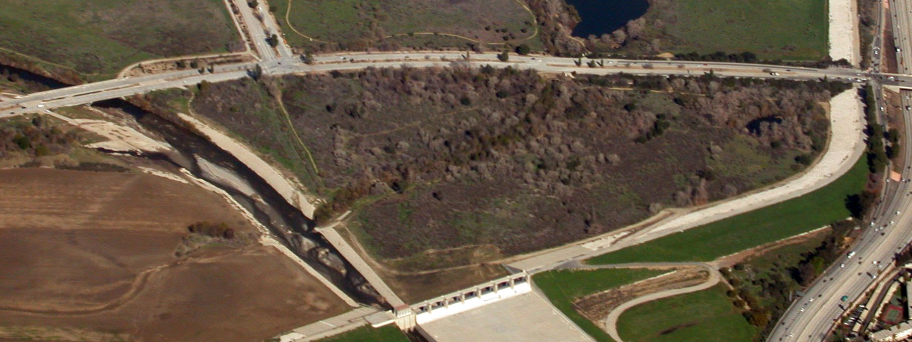
In 1979 the Corp of Engineers developed the first area of the Wildlife Reserve (formerly called the South Reserve), an approximate 48 acre parcel located south of Burbank Blvd and bordered by the Los Angeles River and the Sepulveda Dam on the east and south. A “pothole” pond (fed with piped-in fresh water) was created, and vegetation representing coastal sage scrub and riparian woodlands were planted. This area was drastically altered in December 2012 and as of January 2013 there were ongoing negotiations between environmental groups and the Army Corps of Engineers (see section above below upcoming events).


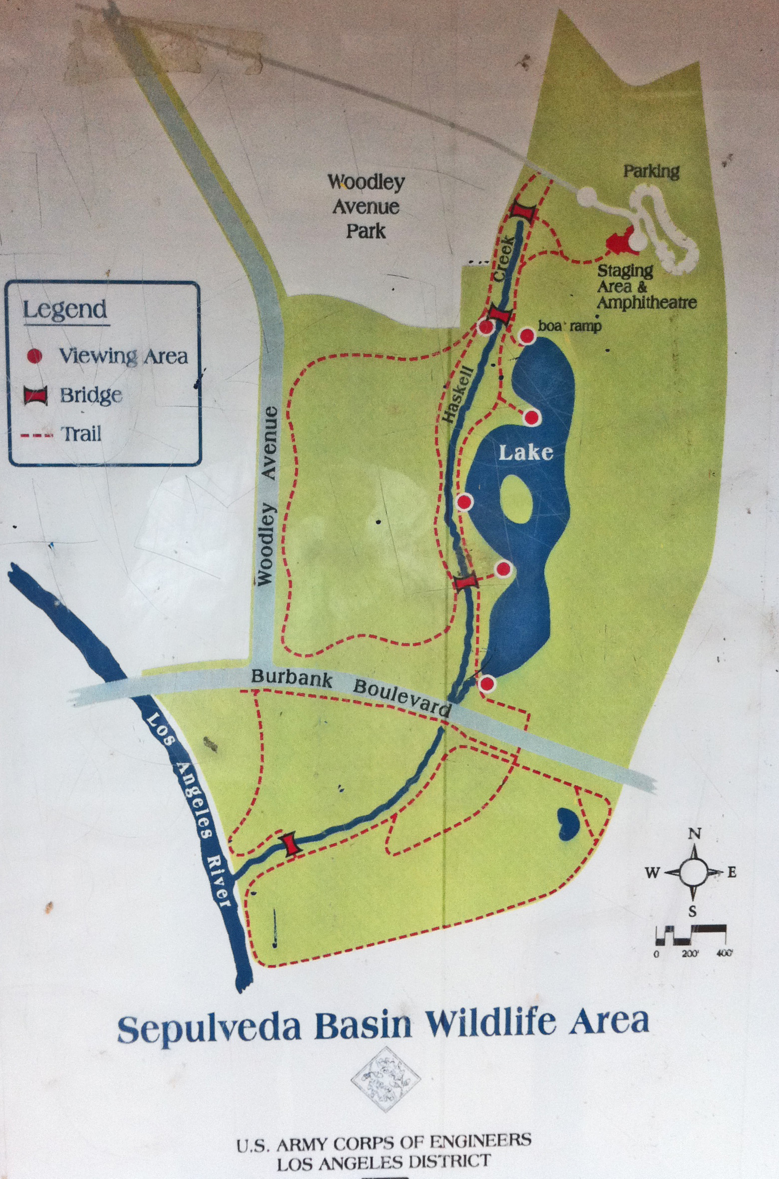
The approximate 60-acre North Reserve (north of Burbank Blvd., east of Haskell Creek, west of the Dam) was developed in 1988,
featuring an 11-acre lake with an island and wildlife viewing stations. Various revegetation projects have been undertaken since then.


above, the stone monuments we call "stonehenge."

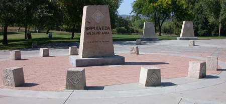
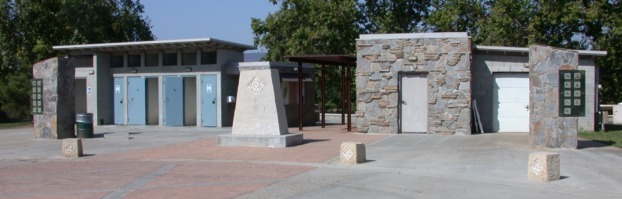
the reserve entrance and restrooms.


In 1991 the Tillman Water Reclamation Plant Flood Protection Project was finalized, and subsequently a berm was built
around the Water Reclamation Plant to protect it from flooding, compensating excavation was performed in various places,
and the outflow from the Water Reclamation Plant was
rerouted under the dam so the outflow was outside
(to the south) of the Dam. The 7-acre berm was planted
with California native plants and is the largest native landscaping project developed by the City of Los Angeles.


above, the berm surrounding the Water Reclamation Plant.


In 1994, the City and Federal governments agreed to sharing the costs on $11 million in improvements in the Sepulveda Basin.
The wildlife are was expanded 110 acres to the west of Haskell Creek (on either side of Woodley Avenue).
Additional facilities in the wildlife area included trails, restrooms and staging area, signs, benches, viewing blinds and parking. This project was completed in 1999.


Member Organizations and Affiliated Agencies


SFV Audubon

California Native Plant Society

L.A. Audubon

Sierra Club, San Fernando Valley Group


The River Project Logo

FoLAR

LA City Rec and Parks

Resource Conservation District

           The Japanese Garden


Other Affiliated Organizations

Southwestern Herpetologists Society
TreePeople


Other Relevant Links

L.A. Creek Freak Blog
Urban Wildlands Group

City of Los Angeles River Website
Los Angeles River Revitalization Corporation
FoLAR LA River Facebook Page


Web page and design by Justin Baker.
Text and captions by Steven L. Hartman.
All photographs taken in the Sepulveda Basin by Steven L. Hartman unless otherwise noted.

;
 

Last Updated 3/5/2024