 |
||||||||||||||
|
||||||||||||||

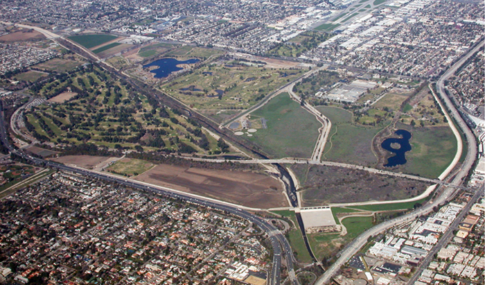
| Below is an aerial map of the Sepulveda Basin and its surrounding areas. Mouse over the areas of the wildlife preserve to find out more... or click on the appropriate area to go to that page. |
|
| Click on Map View to get a different perspective on the areas of the Basin. Click Sattelite View to return to the original image.. |
 |
 |
|||||
 |
|